


20241122 La Foret fouesnant

Childebert
User
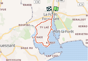

Length
5.2 km

Max alt
31 m

Uphill gradient
58 m
Km-Effort
6 km

Min alt
0 m

Downhill gradient
57 m
Boucle
Yes
Creation date :
2024-11-22 12:29:20.6
Updated on :
2024-11-22 14:14:33.37
1h44
Difficulty : Easy

FREE GPS app for hiking
 SityTrail
IGN / Geographical institutes
SityTrail Plus
The world is yours!
About
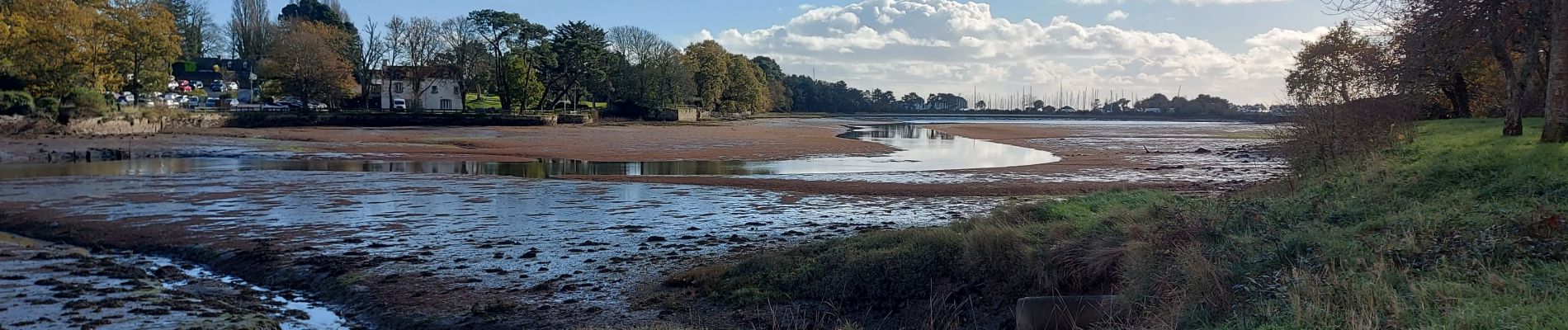
Trail Walking of 5.2 km to be discovered at Brittany, Finistère, La Forêt-Fouesnant. This trail is proposed by Childebert.
Photos

Positioning
Country:
France
Region :
Brittany
Department/Province :
Finistère
Municipality :
La Forêt-Fouesnant
Location:
Unknown
Start:(Dec)
Start:(UTM)
426900 ; 5306675 (30T) N.
Comments